LAND 21 – Lundestenen to Vasagård, 26.05.23

Denne side på dansk her

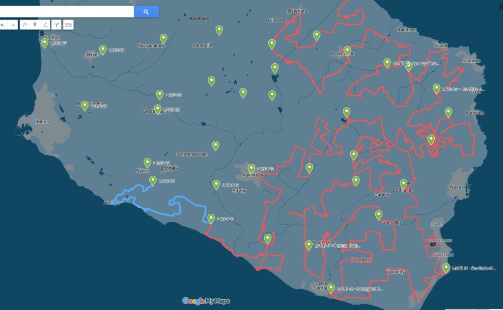
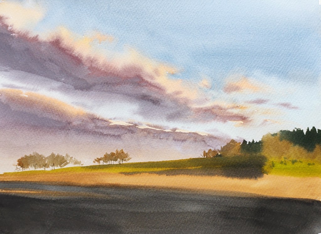
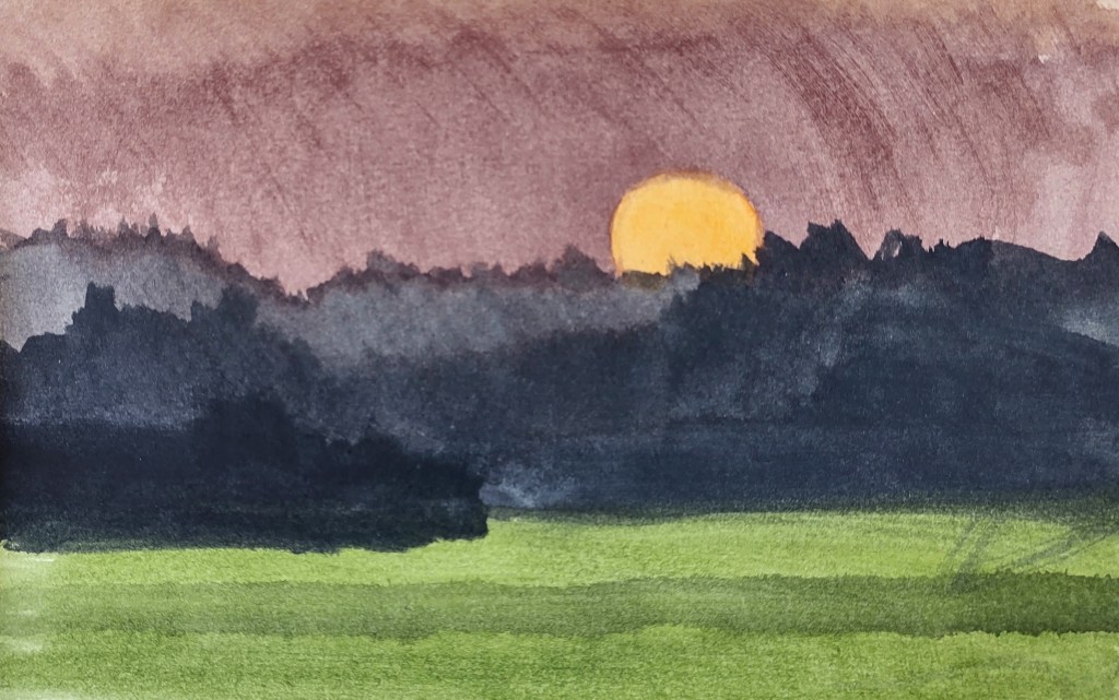
LAND 21 The day began cold and rather breezy. I watched the sun rise behind the trees – a luminous crimson disc, slowly turning orange and then yellow as it began its ascent into the clear blue sky.

Sunrise from Hovedgårdsvejen

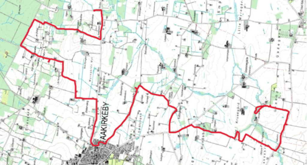
I headed north on familiar roads.

Nylars Church from Hovedgaardsvejen

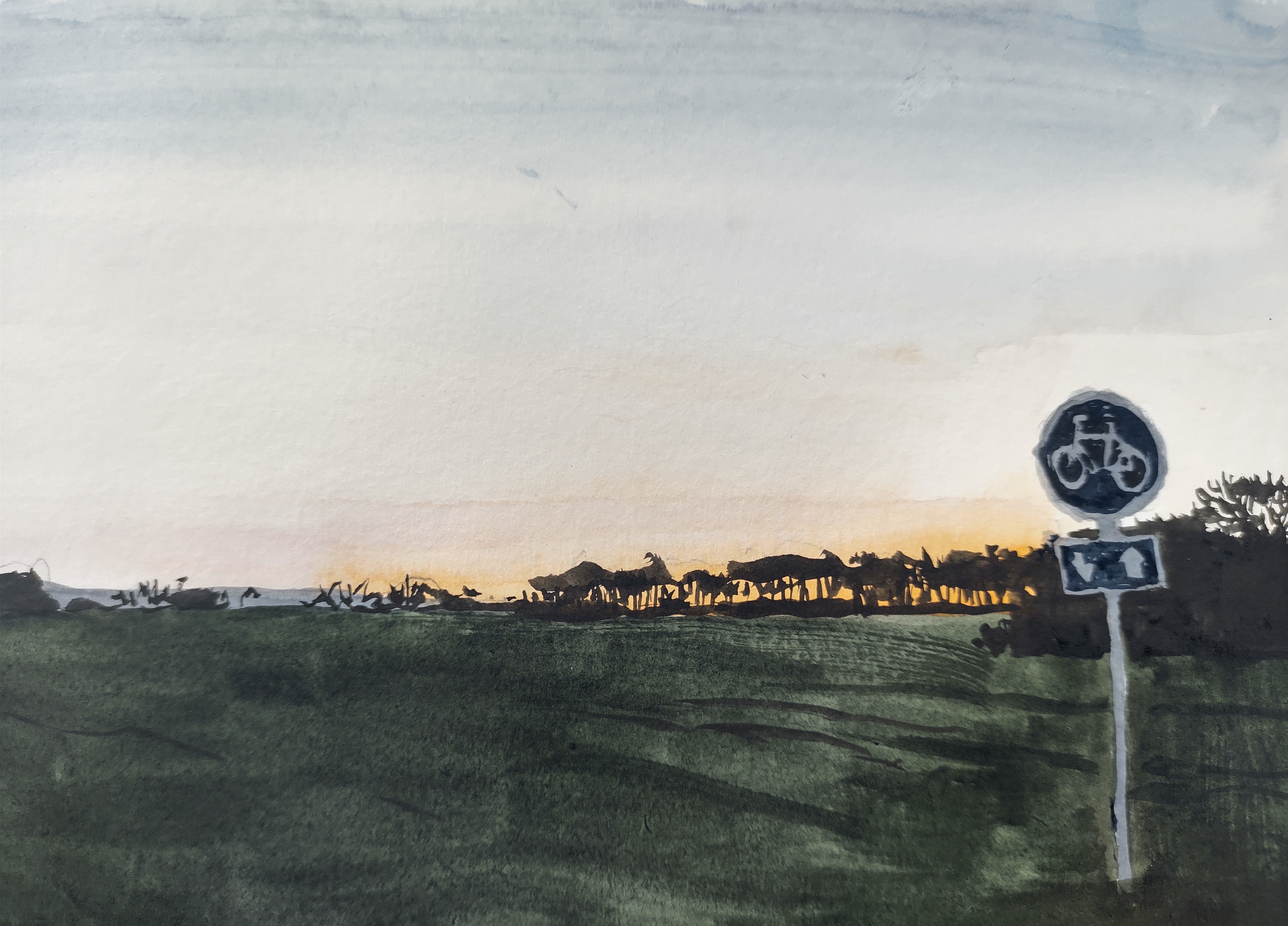
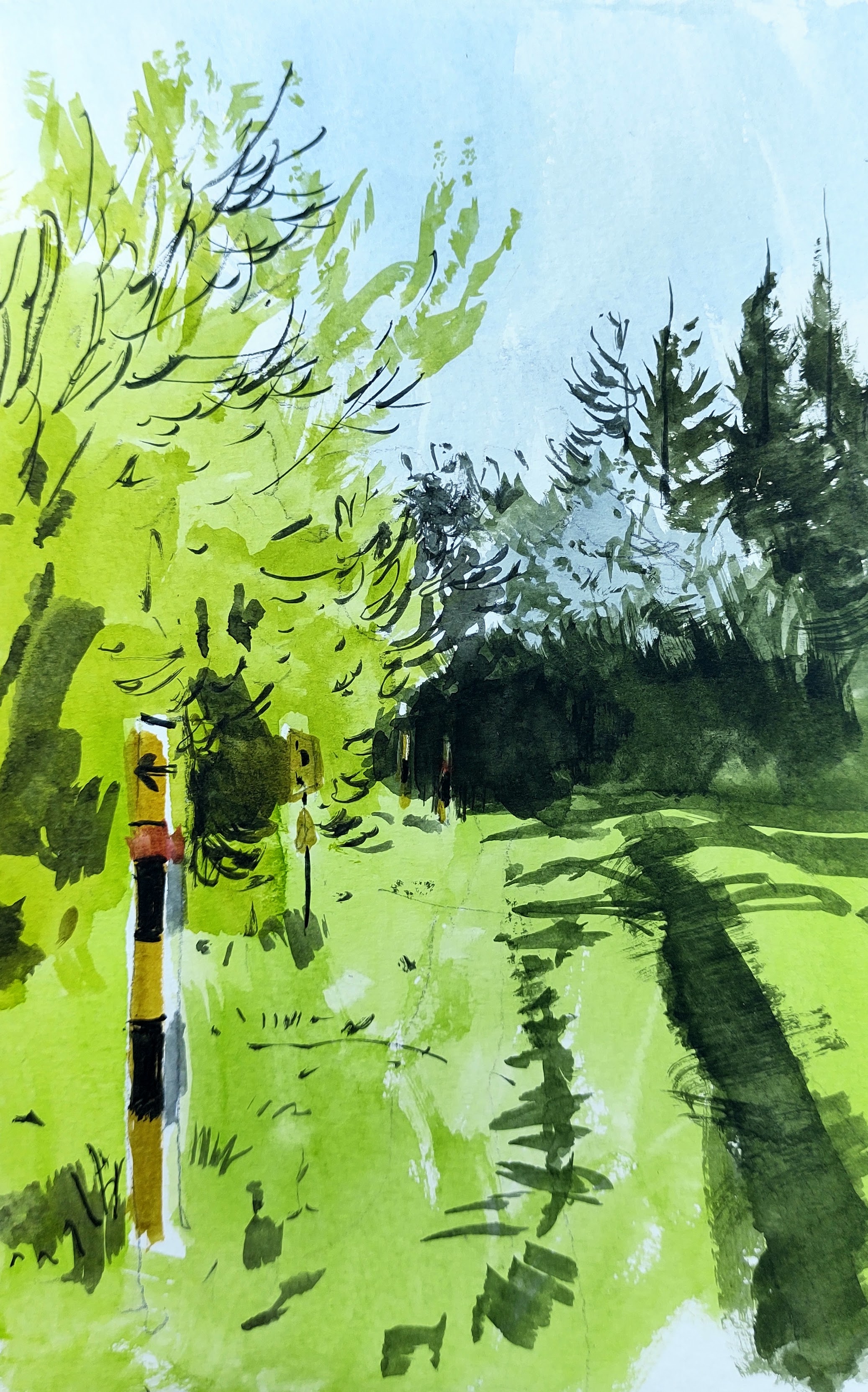
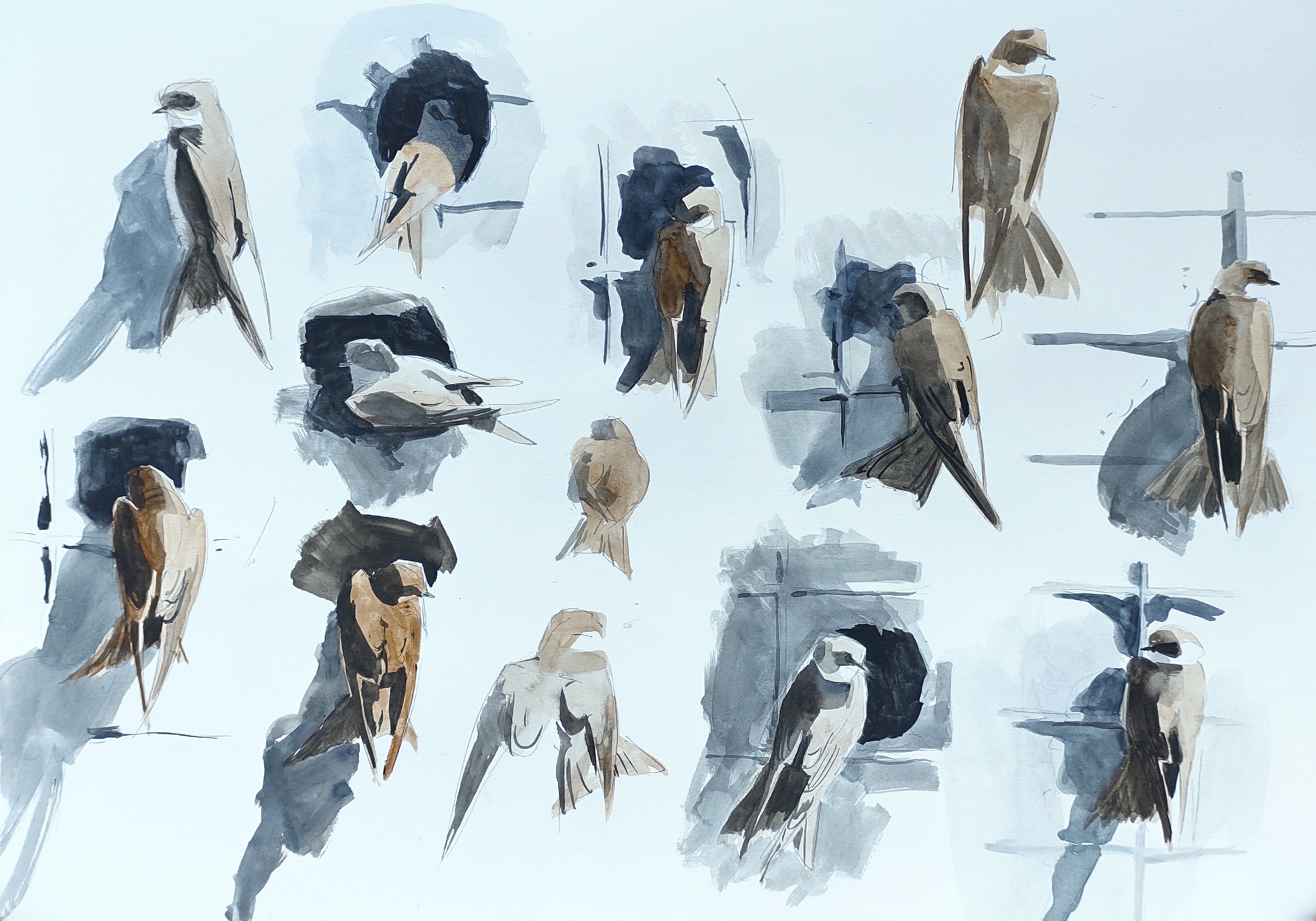
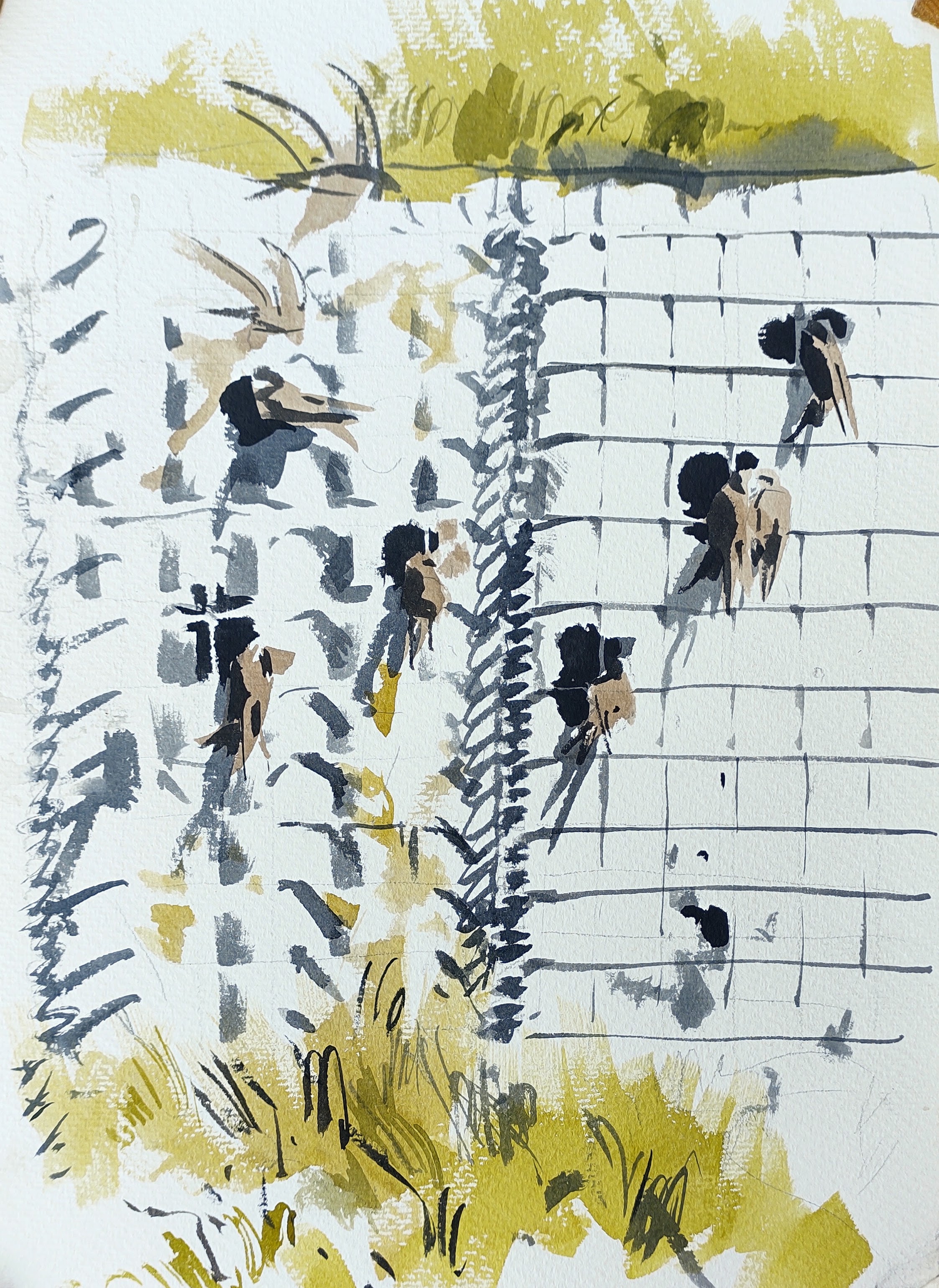
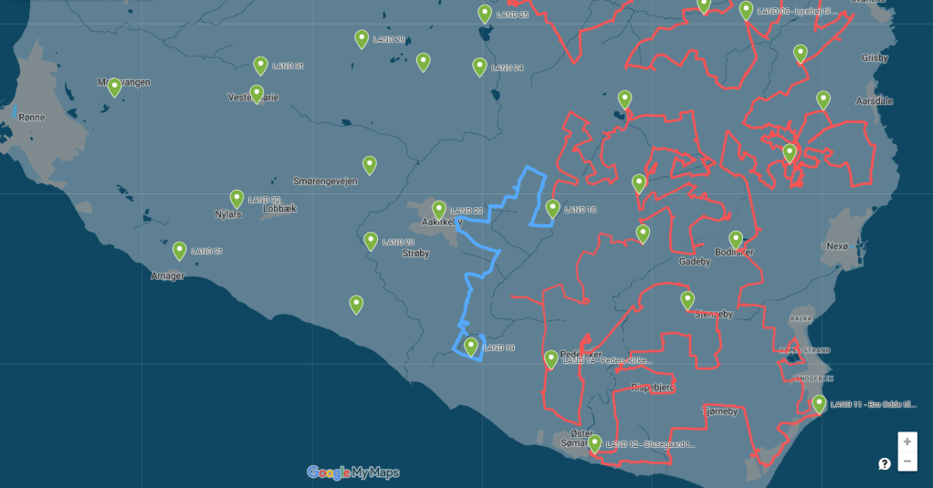
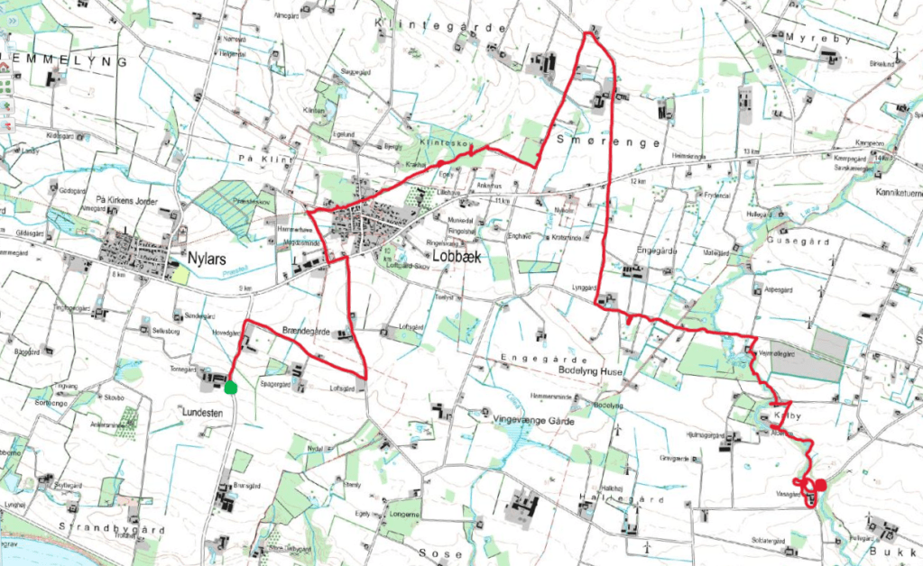
Soon I found myself walking along the bike path towards Lobbæk village. The path was built on the old railway track that connected Rønne with Aakirkeby. Lobbæk was built around a railway station in the early 20th century – at one point boasting several shops, a baker, a dairy and so on – and is still home to several hundred people. I stopped for breakfast by the old station and enjoyed the cacophony of birdsong. A red-backed shrike was an unexpected visitor. Swifts, my first of the year, screamed overhead.

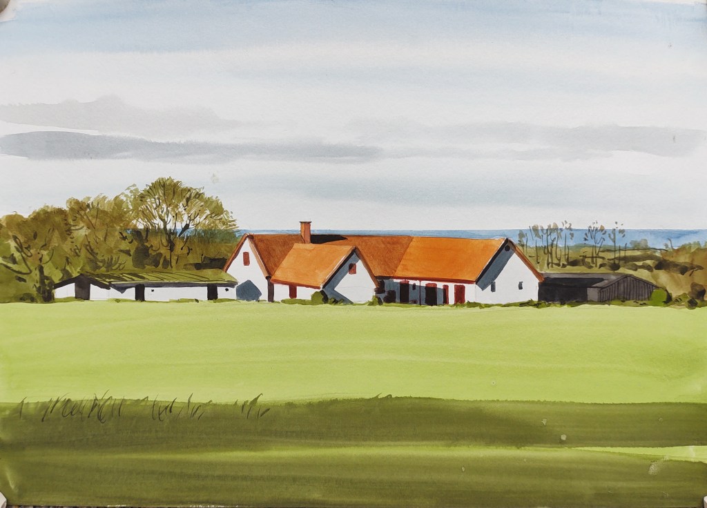
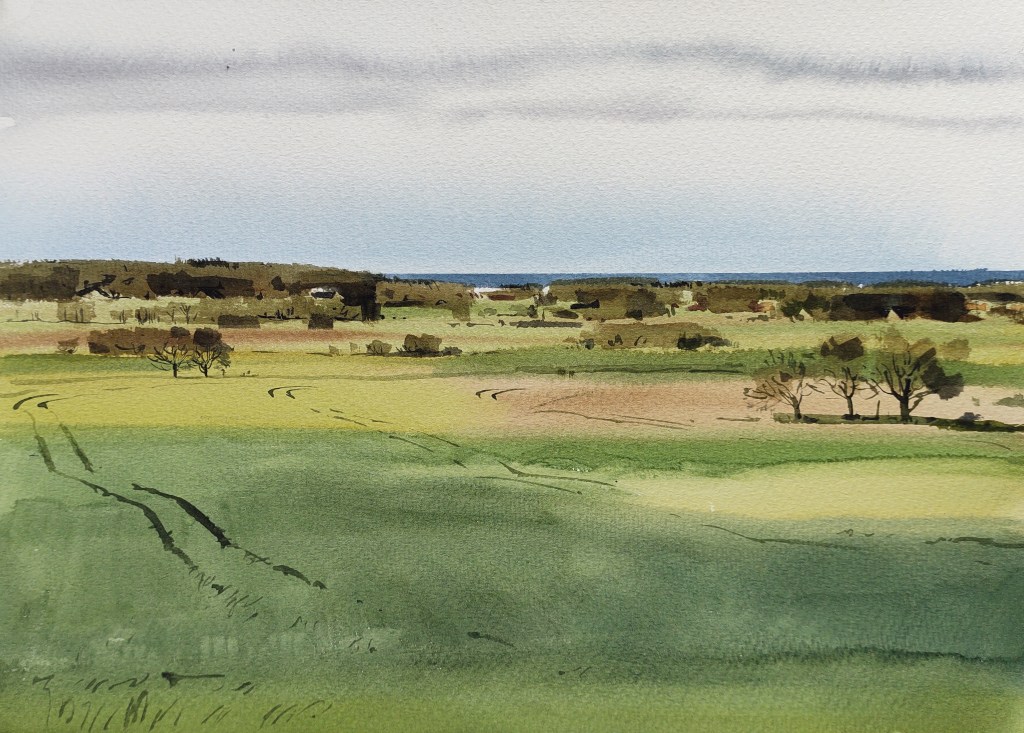
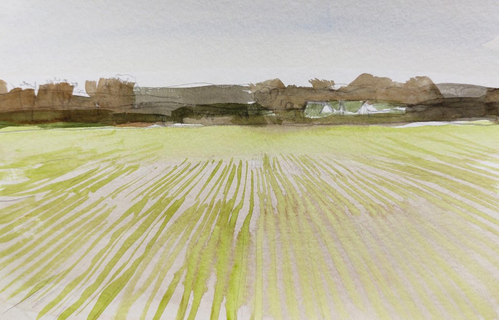
I continued along the bike path for a while, and then headed north into the intensively cultivated fieldscape between Nylars and Vestermarie. The area had once been a mixture of pasture, marsh and heath, and had slowly been drained and cultivated over the centuries. Large dairy and pig farms were strung along the landscape.

Udsigt fra Smørenegevejen

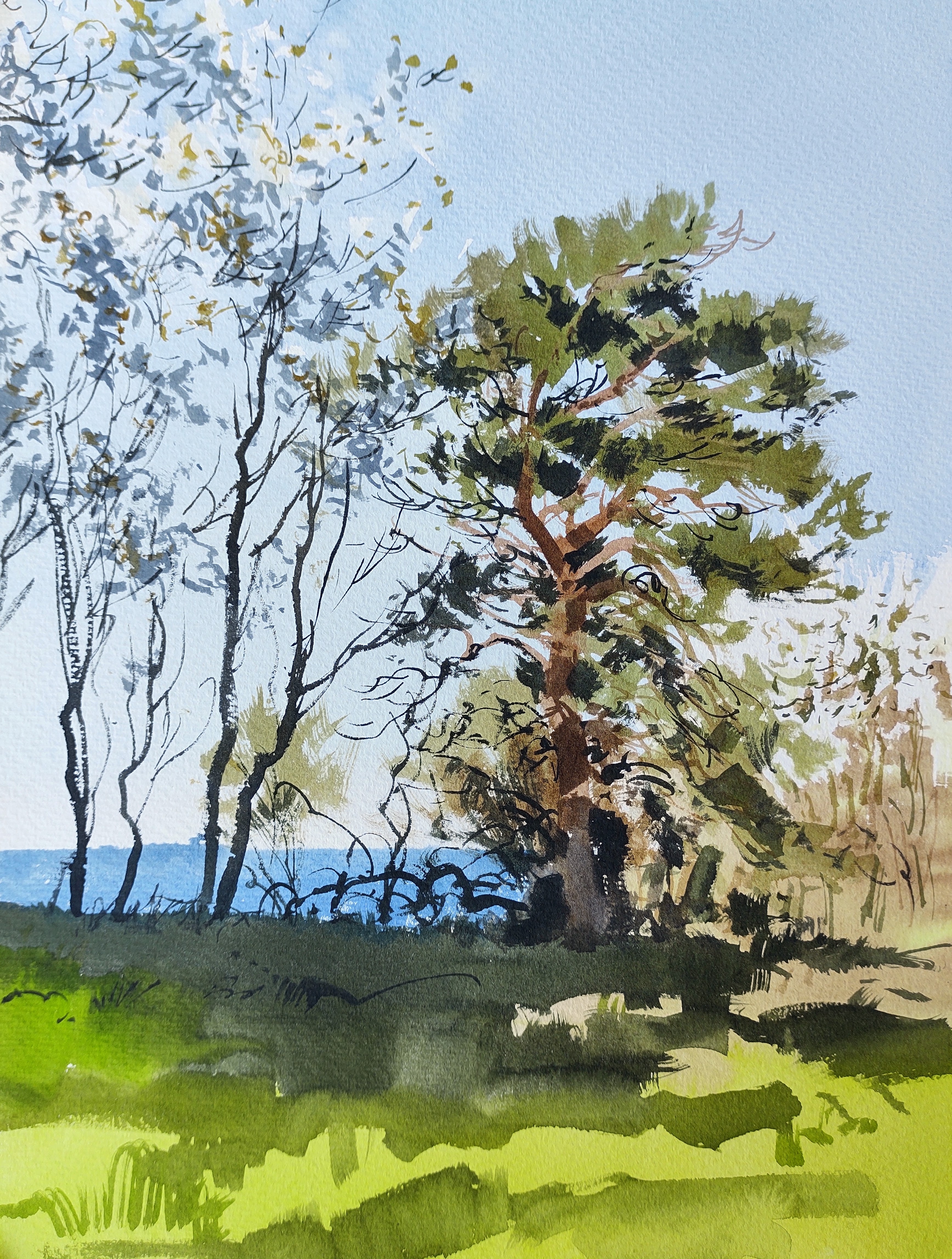
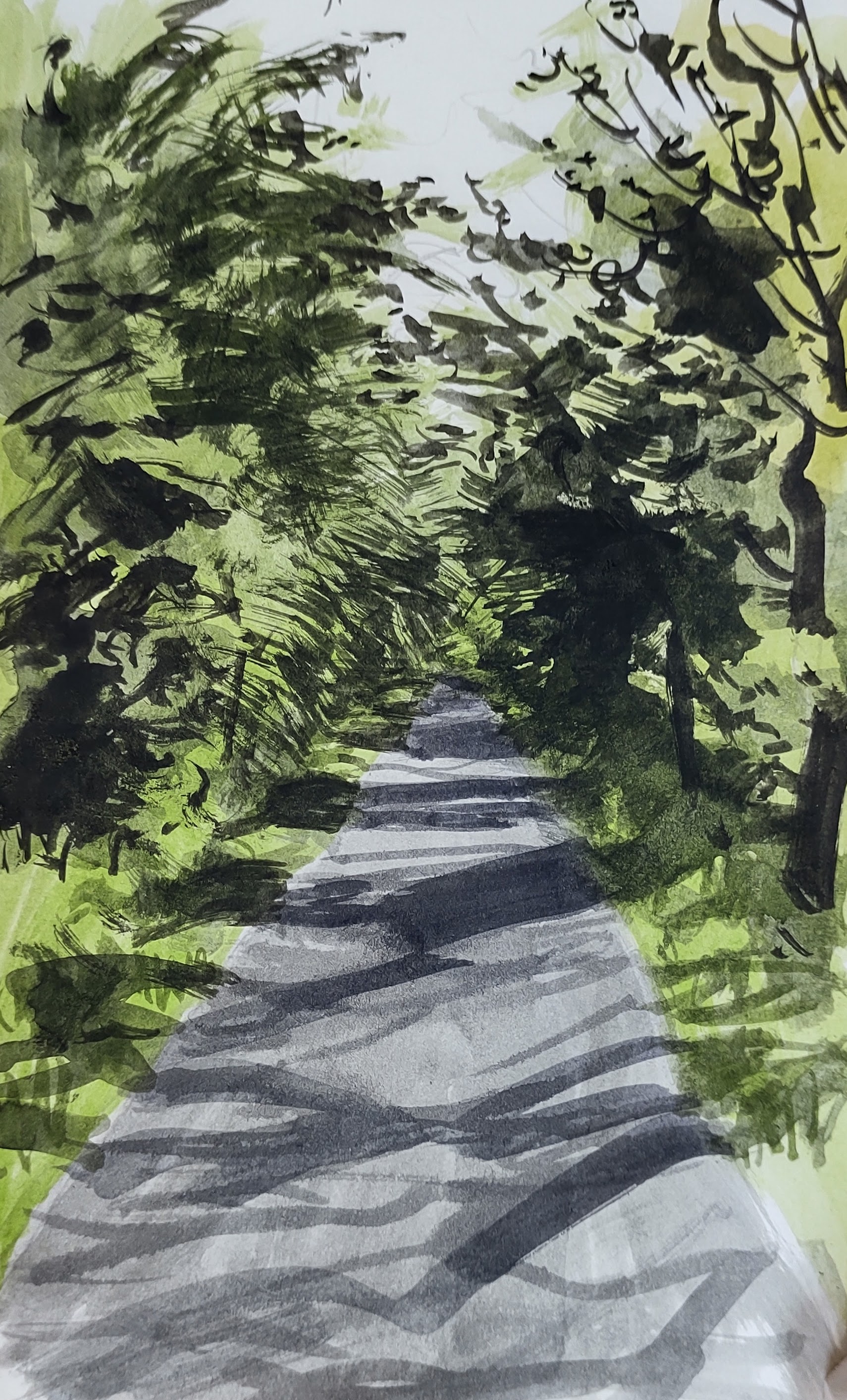
My route took me south again, across the main road and into an area with smaller farms and homesteads, poorer soils, and more variety of vegetation. I headed east until I crossed Læse å, a small stream (though Bornholm’s second biggest) that on account of its unique geology and nature, is protected by law. For several kilometers a public path follows the stream along its heavily wooded valley, with fantastic information panels describing the succession of geological strata the stream flows over.

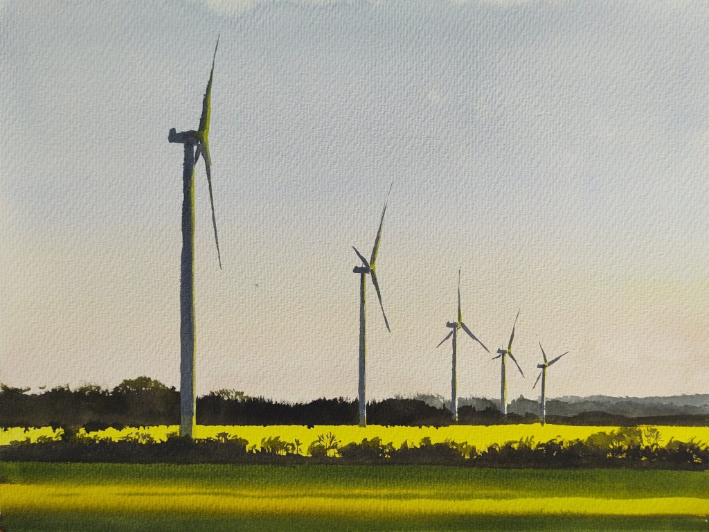
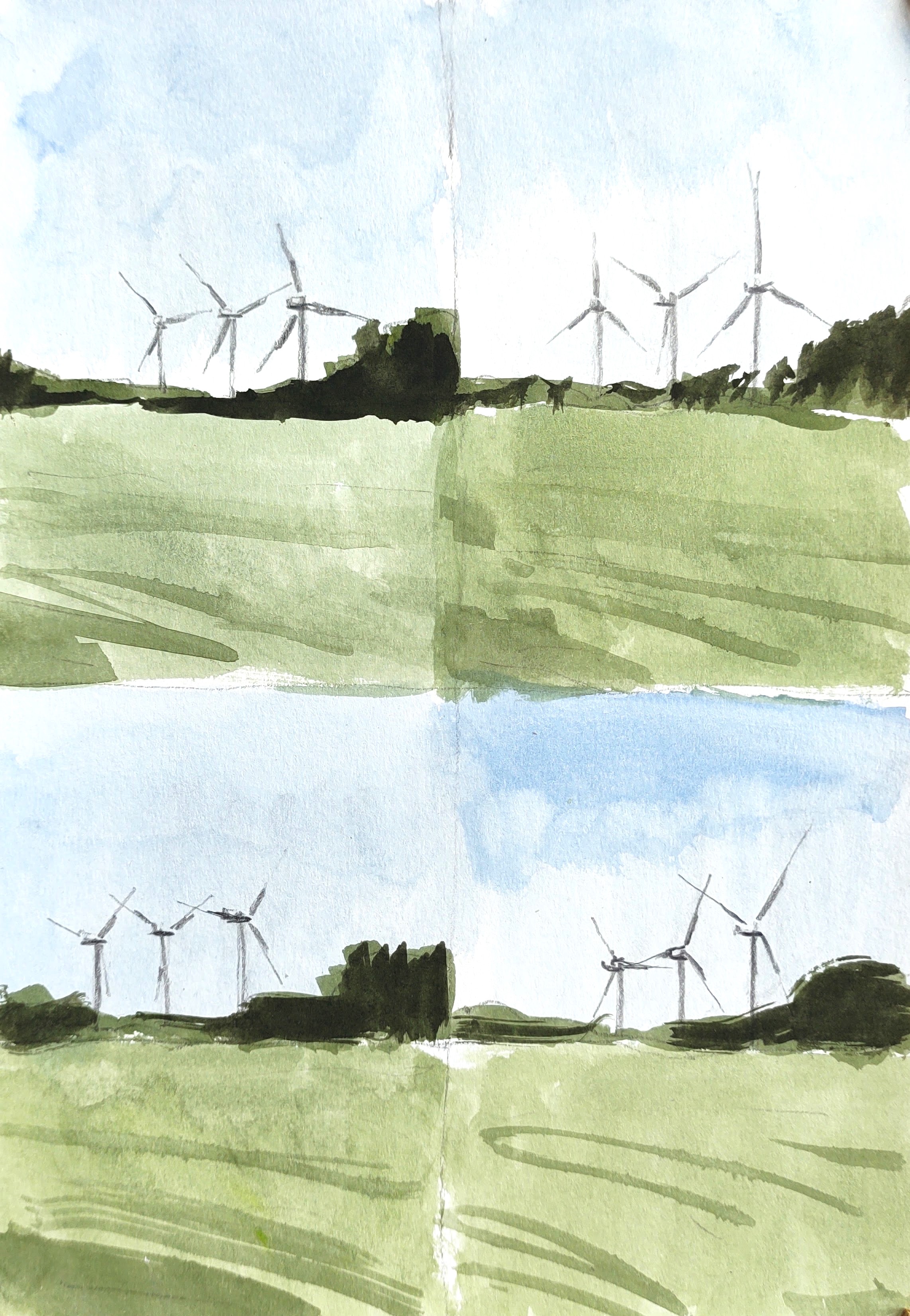
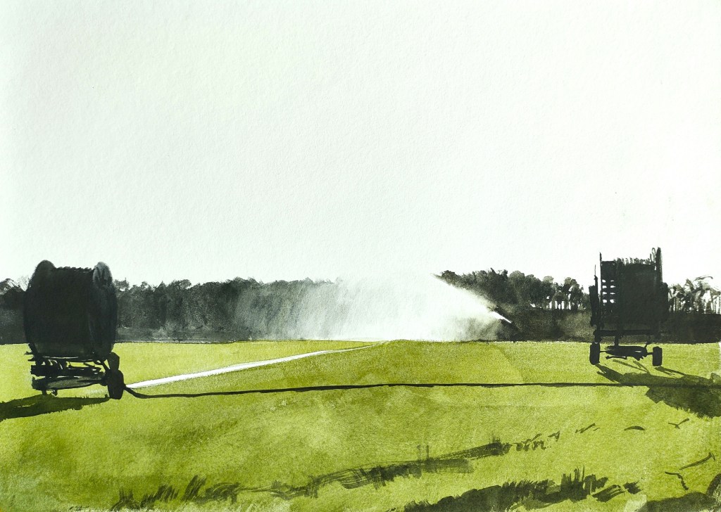
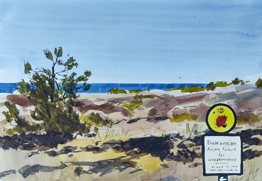
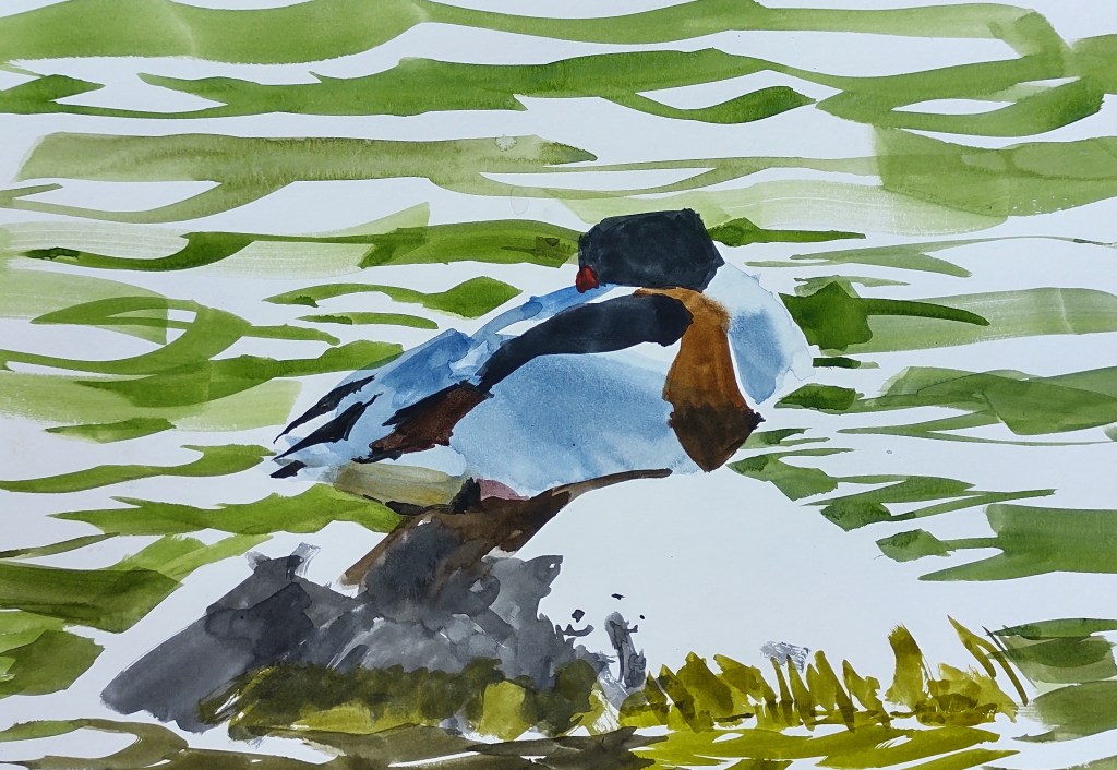
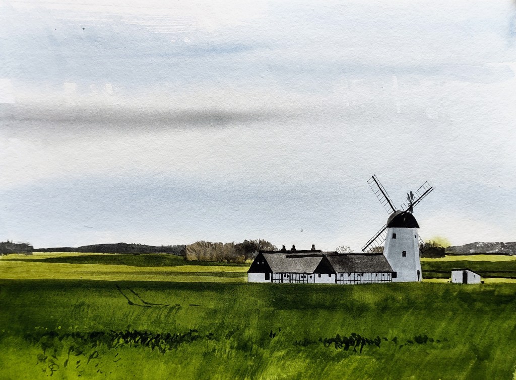
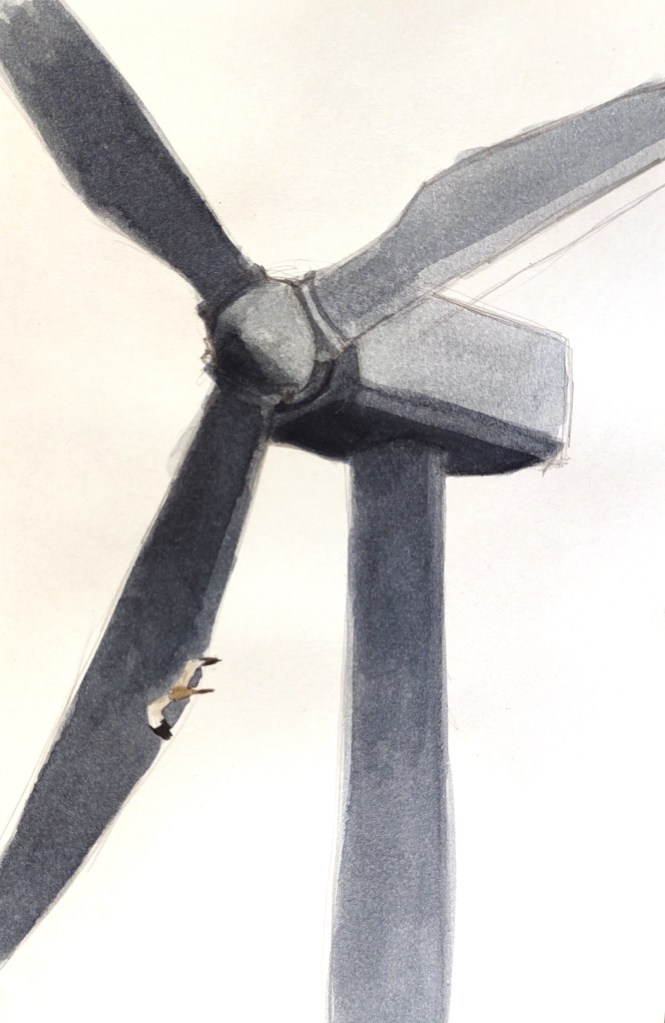
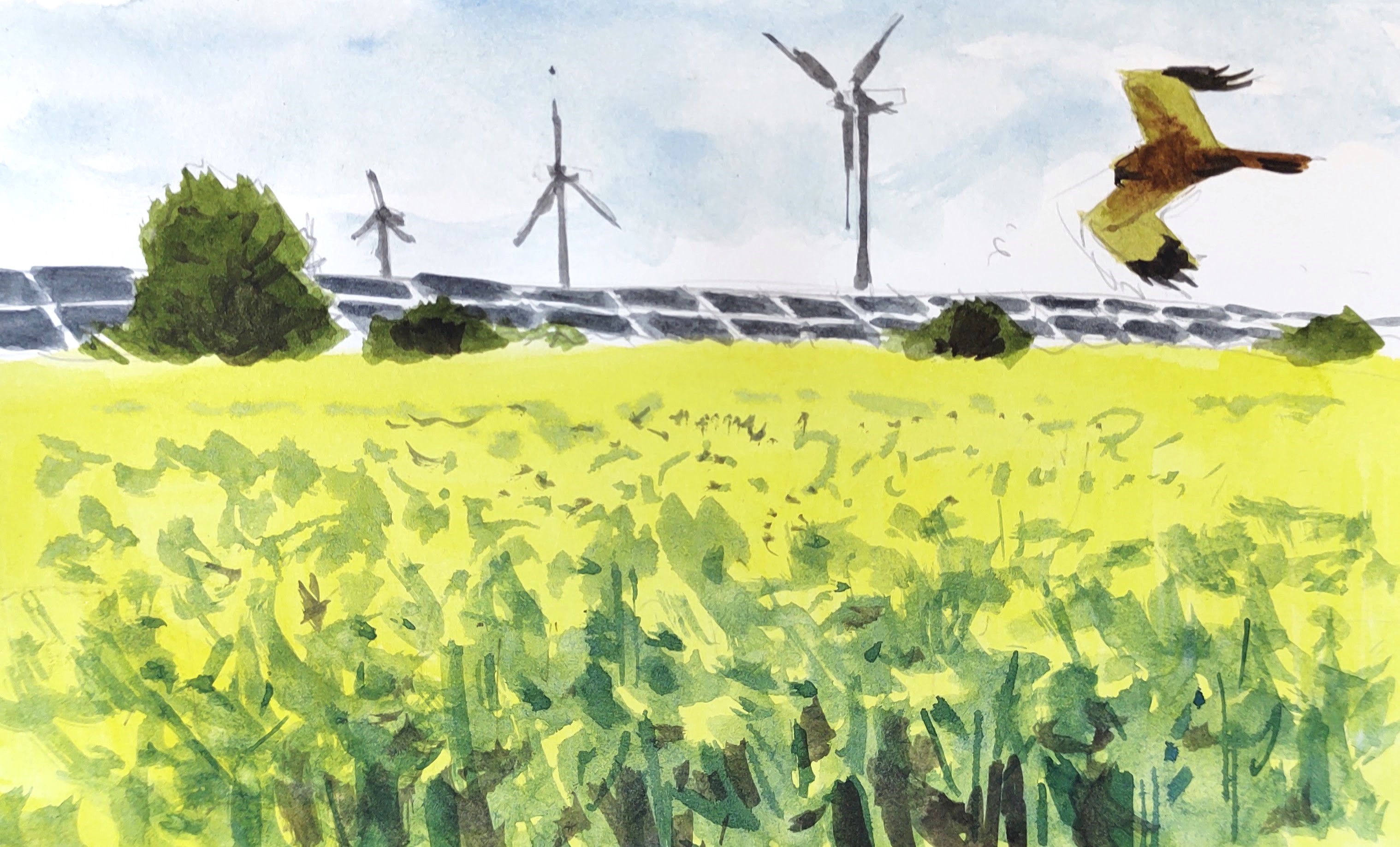
Huge windmills and a giant solar cell park welcomed visitors to the beginning of the path. I watched through my binoculars as a marsh harrier flew close to the huge rotating arms of the windmill.

Marsh harrier and windmill

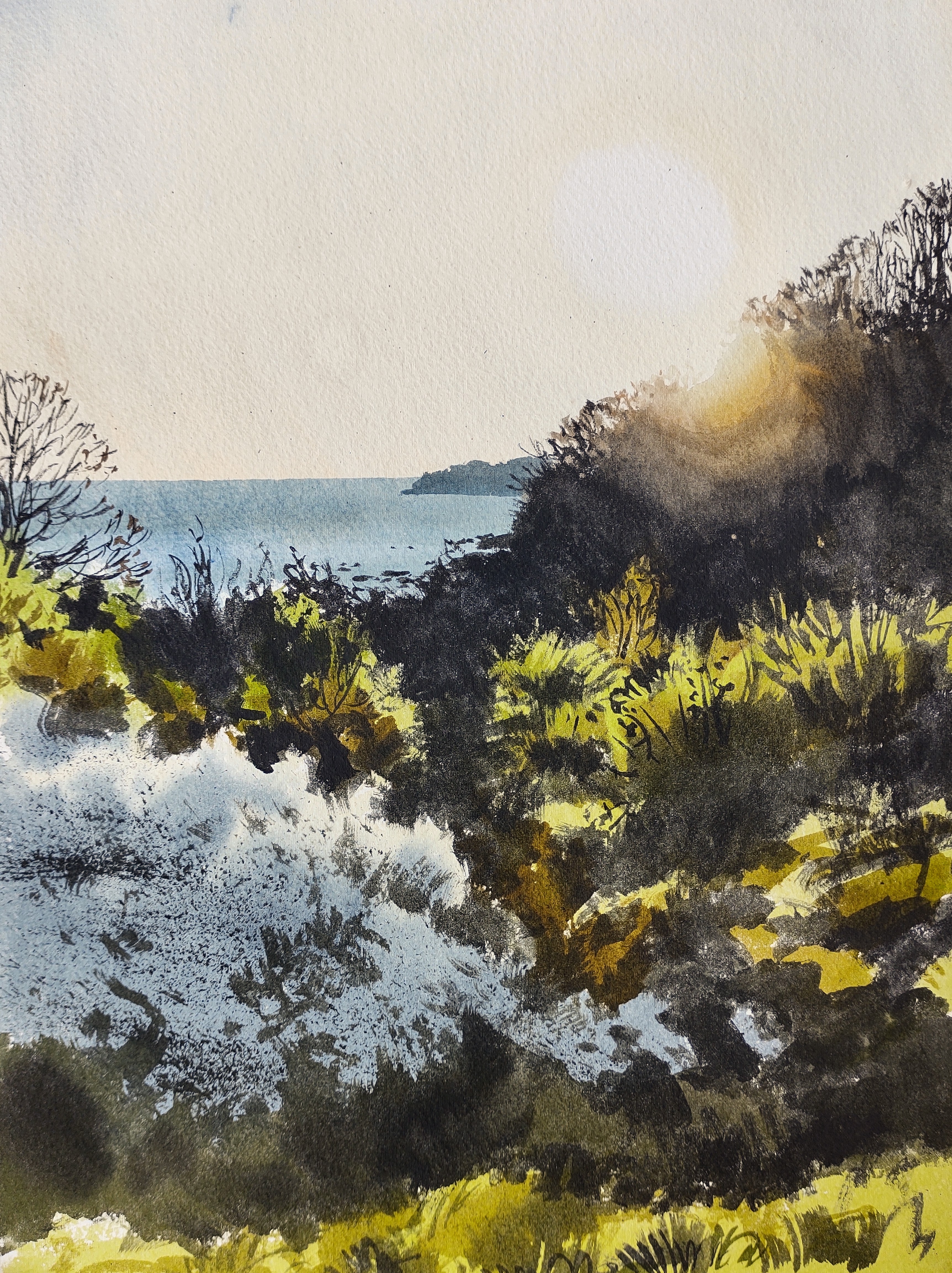
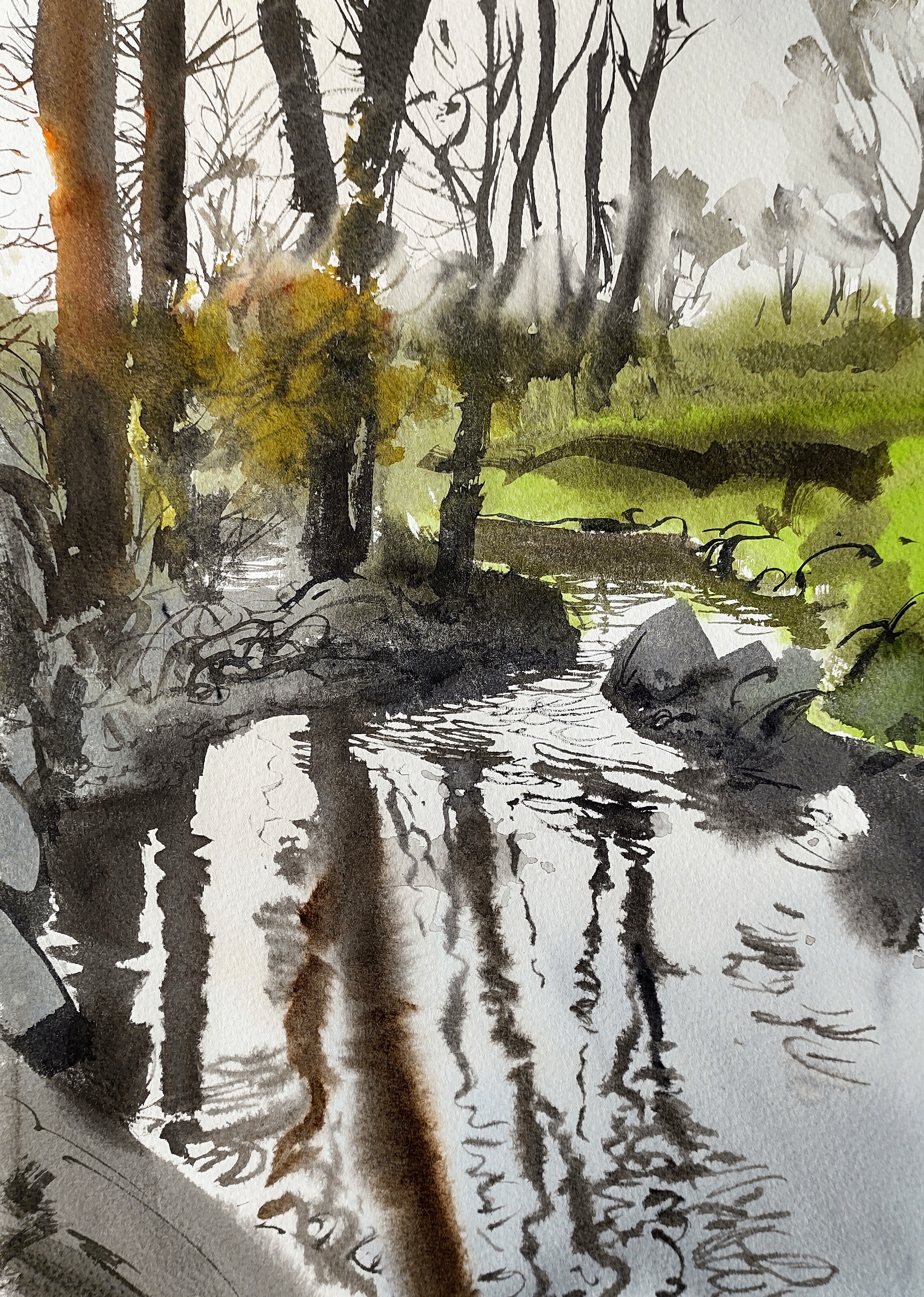
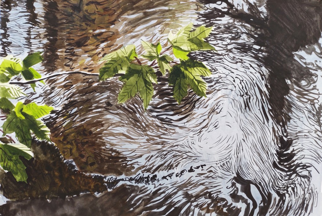
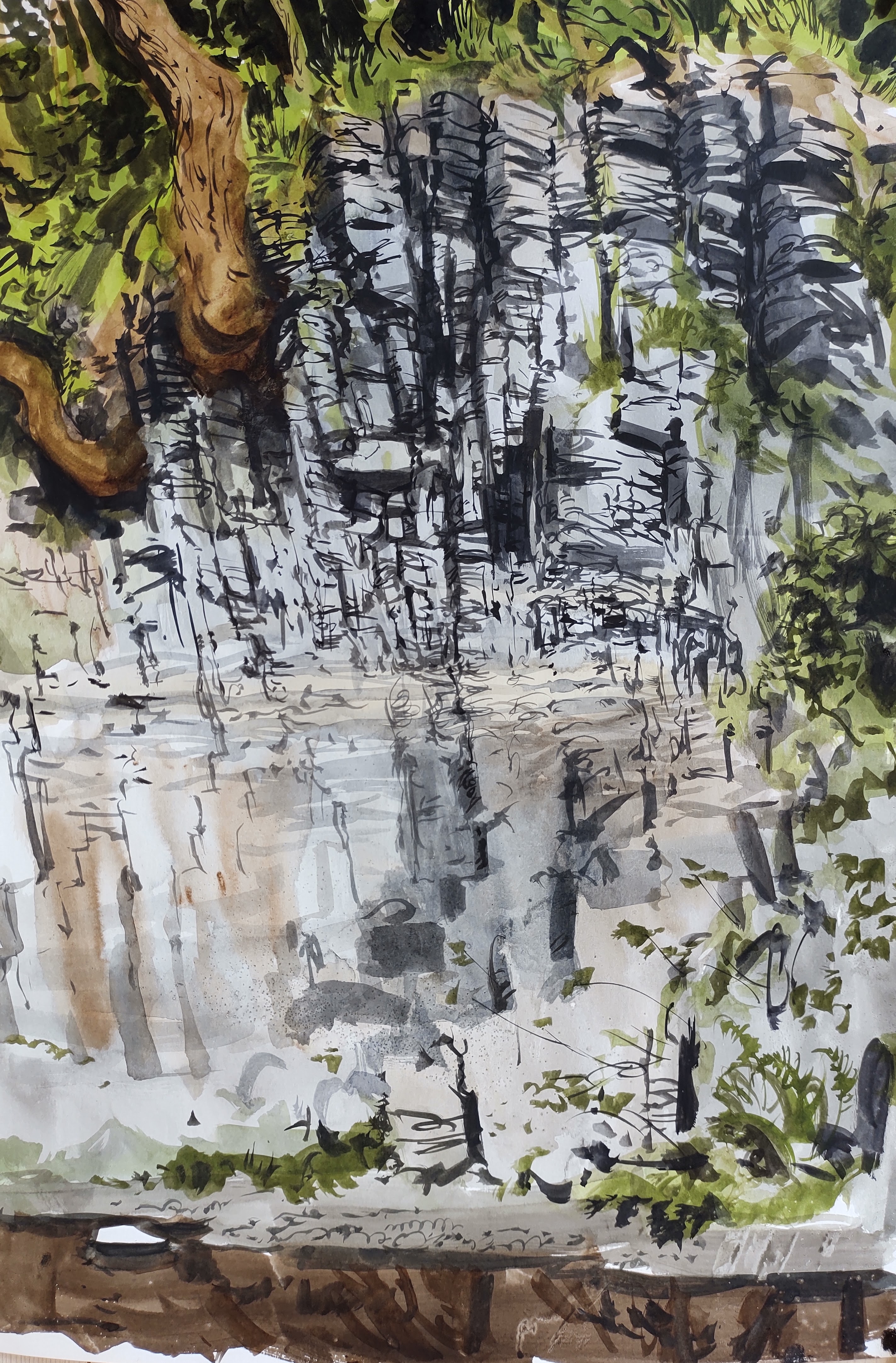
Down by the stream I was sheltered from the breeze, but easy prey for mosquitos. I was entranced by my eye’s ability to see reflections on the surface and stones on the stream bed, but not both simultaneously.

Reflections, Læseå

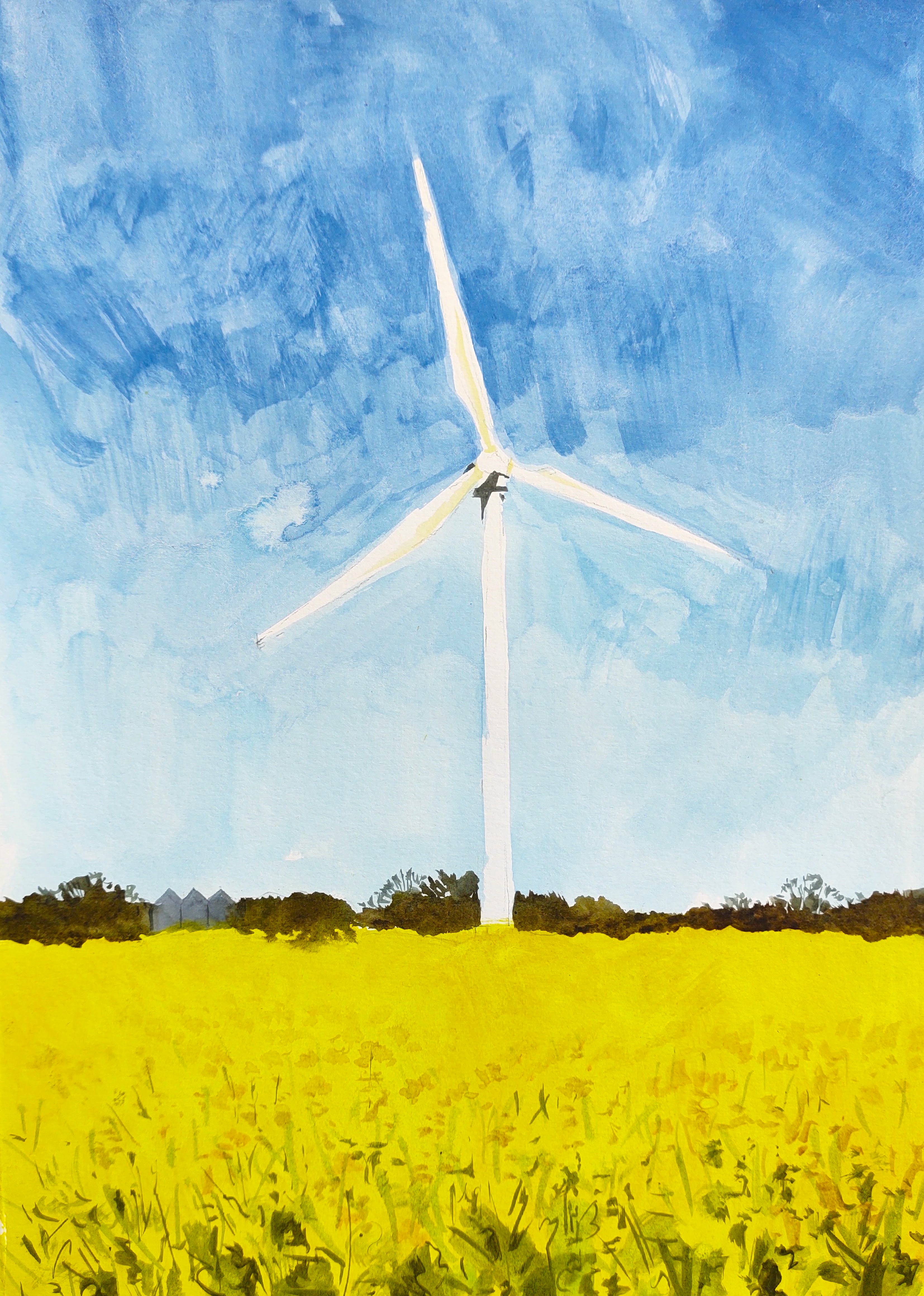
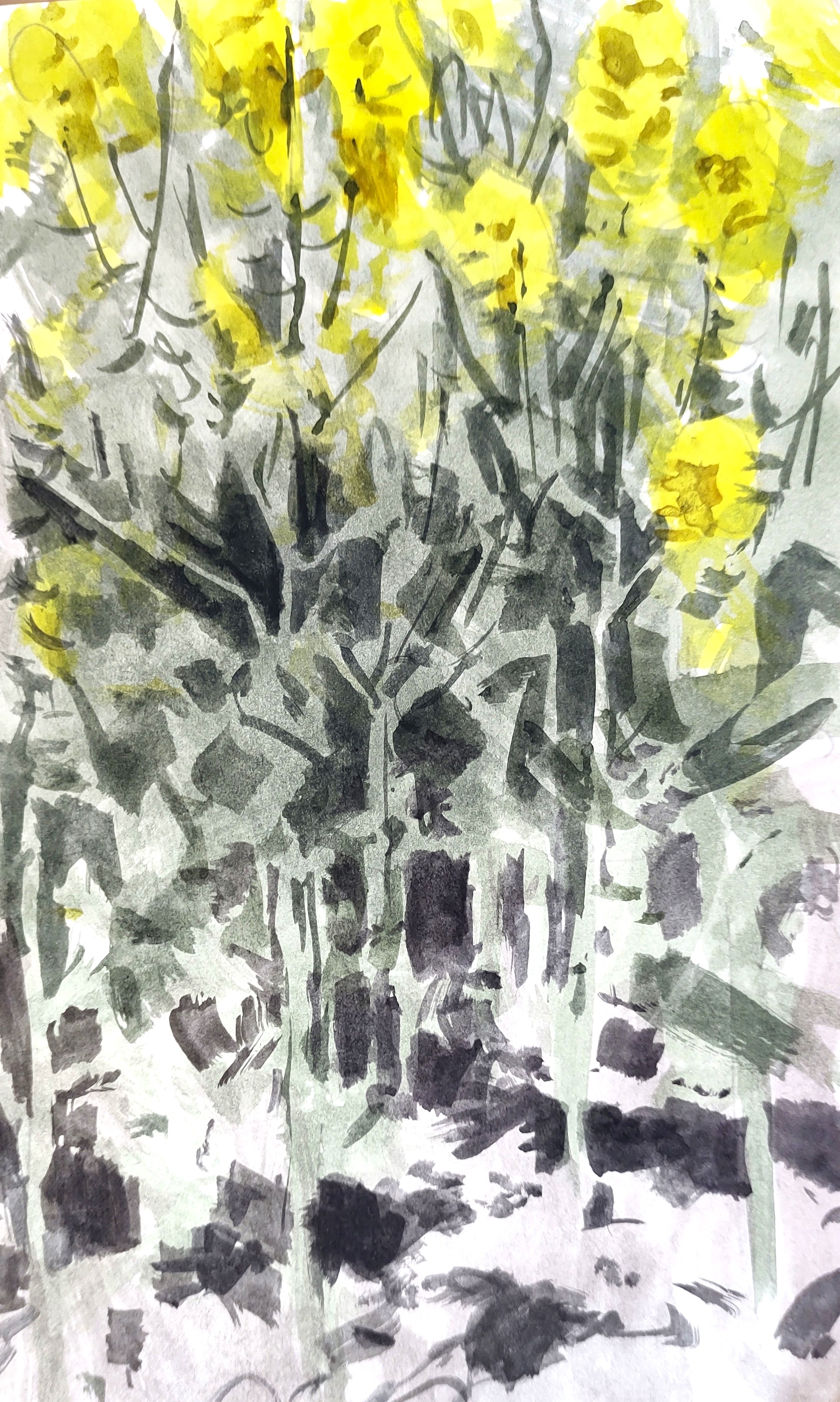
I took a break by the side of an oilseed rape field, now fading a little. A low-flying marsh harrier was lit yellow by reflected light from the flowers.

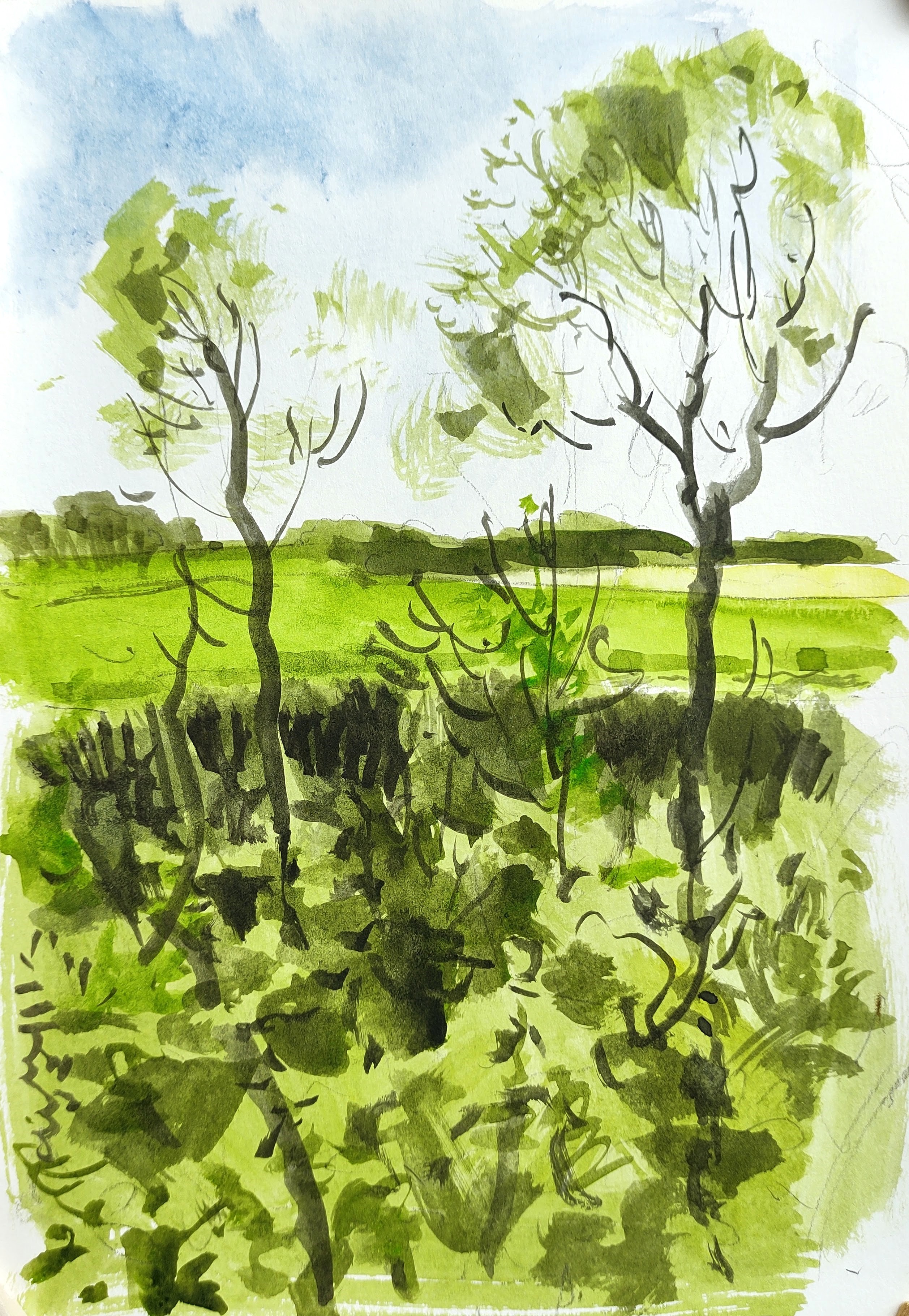
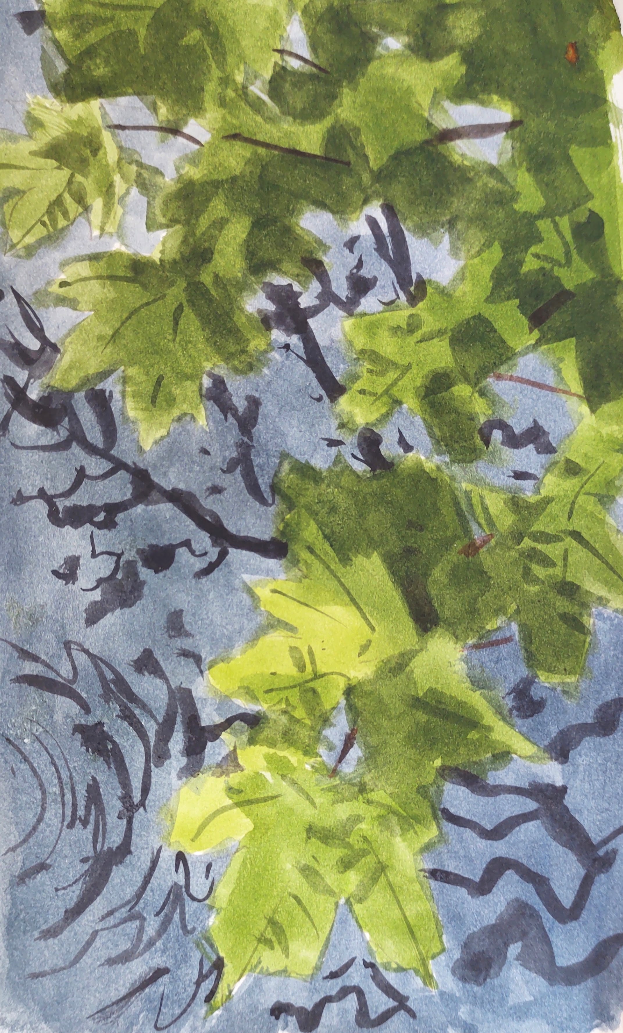
Down in the wooded valley again, I felt overwhelmed by the insane visual complexity of the vegetation and water, by the myriad patches of sunlight and shadow, the colours, patterns, and shapes – all flickering with the wind. I tried desperately to simplify what I saw but to no avail.

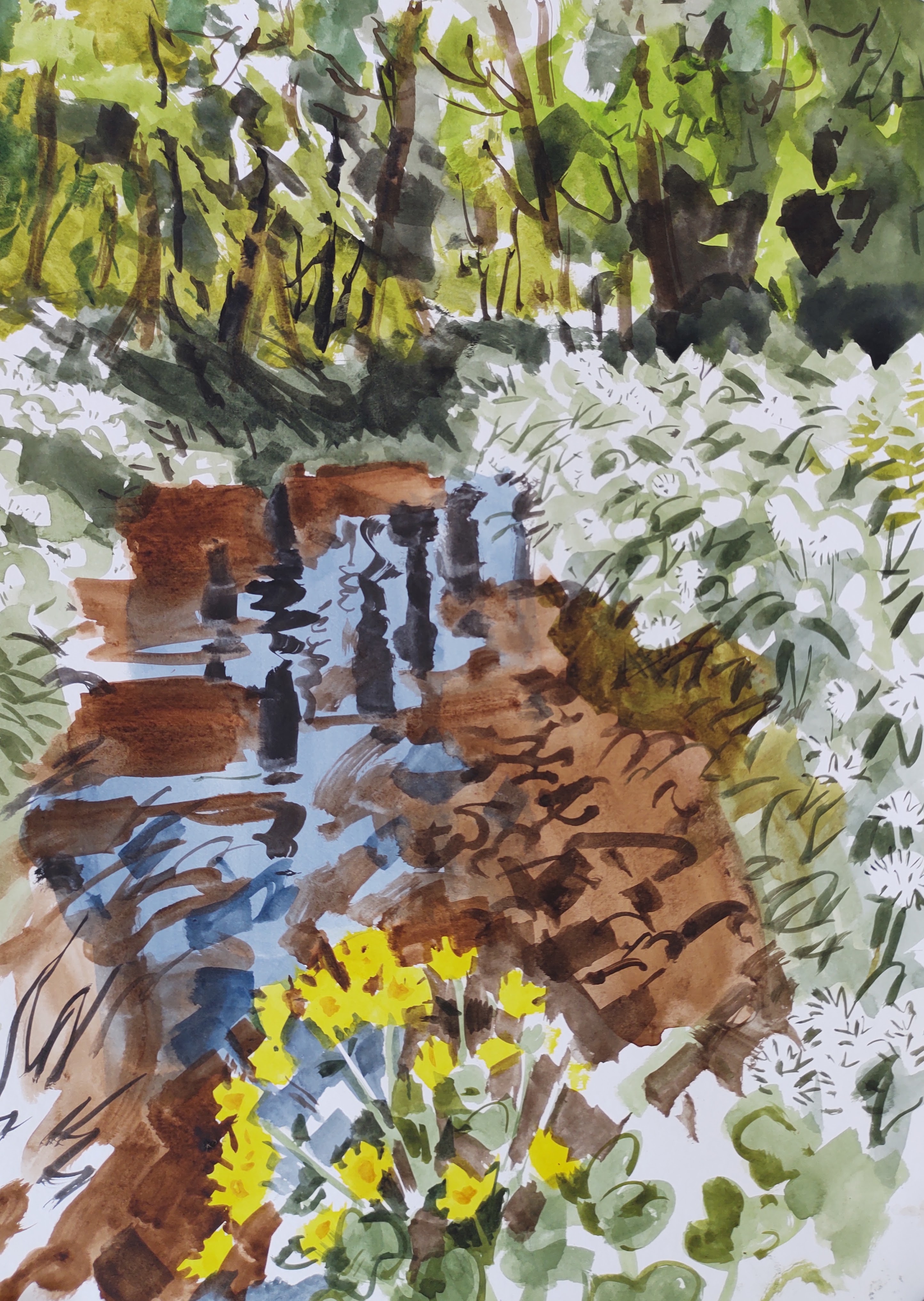
Where the stream bends and meanders through a flower-rich meadow heavy with the scent of wild garlic, I spent a while trying to capture the layers of shale. Curious horses watched my every move. As evening fell, they became skittish and galloped about.

Graptolite shale, with layer of bentonite (volcanic ash)

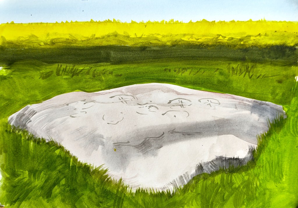
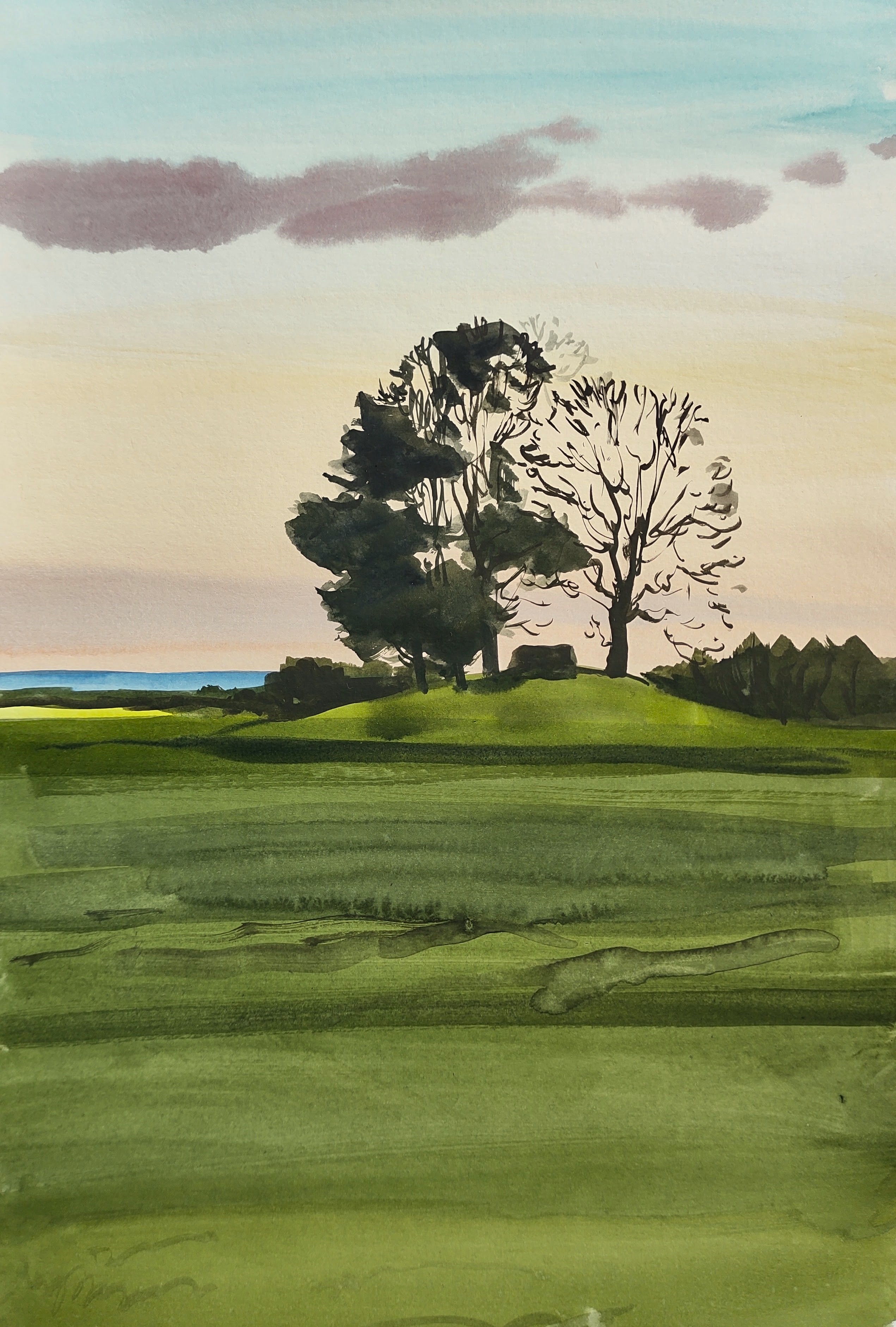
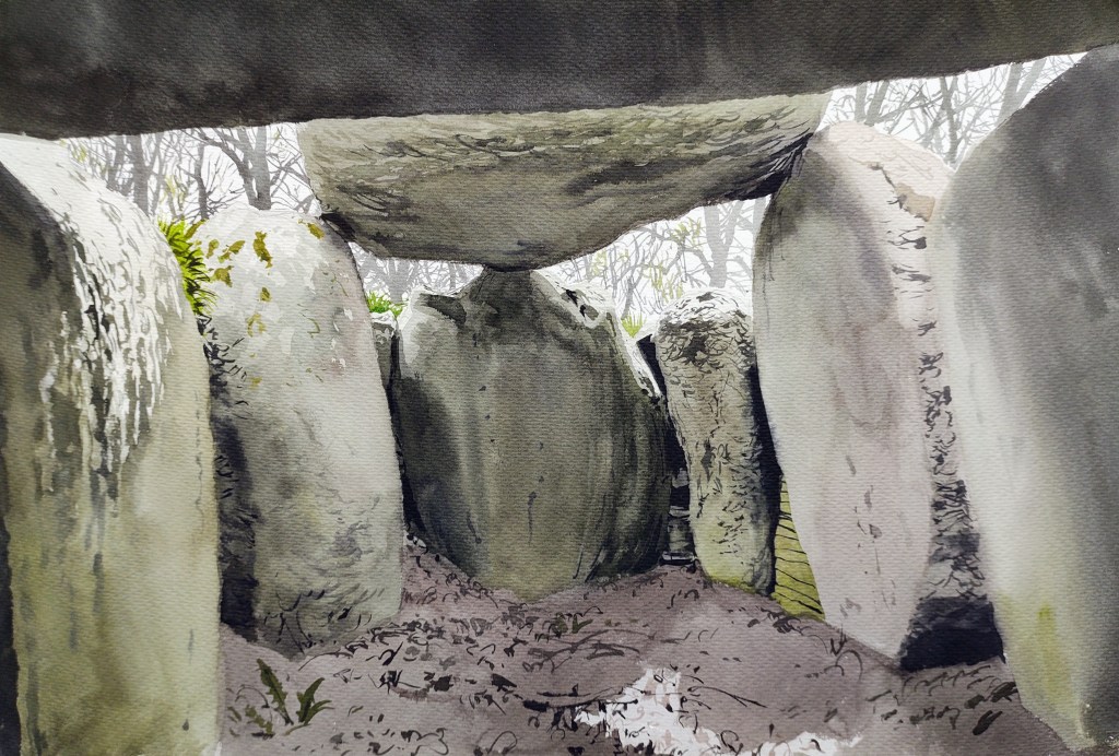
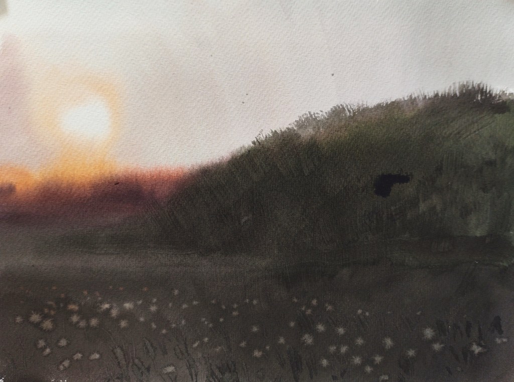
I followed the path out of the valley into the open fields of Vasagård – one of Bornholm’s, and indeed Denmark’s, most important archaeological sites. A cromlech was built in the early Neolithic period over 5,500 years ago, then a passage grave, and then both were combined into one barrow. Here funerals and other ritual activities have taken place over thousands of years. I crawled inside and along the passage into the pitch-black inner chamber and tried to imagine all that history. Outside again, the sun set behind the mound, with the entrance looking like an eye into another universe.

Langehøj ved Vasagård

LAND 21

WEATHER REPORT – Sunny most of the day. Temperature 10 – 15 degrees. Wind 6 m/s from the northwest. Hours of precipitation: 0 hours. Hours of sunshine: 12 hours.

STOPS with the BIVVY – 0

KILOMETRES WALKED – 15.01 km

DAY LASTED – 16h and 42 m

PEOPLE TALKED TO – 2

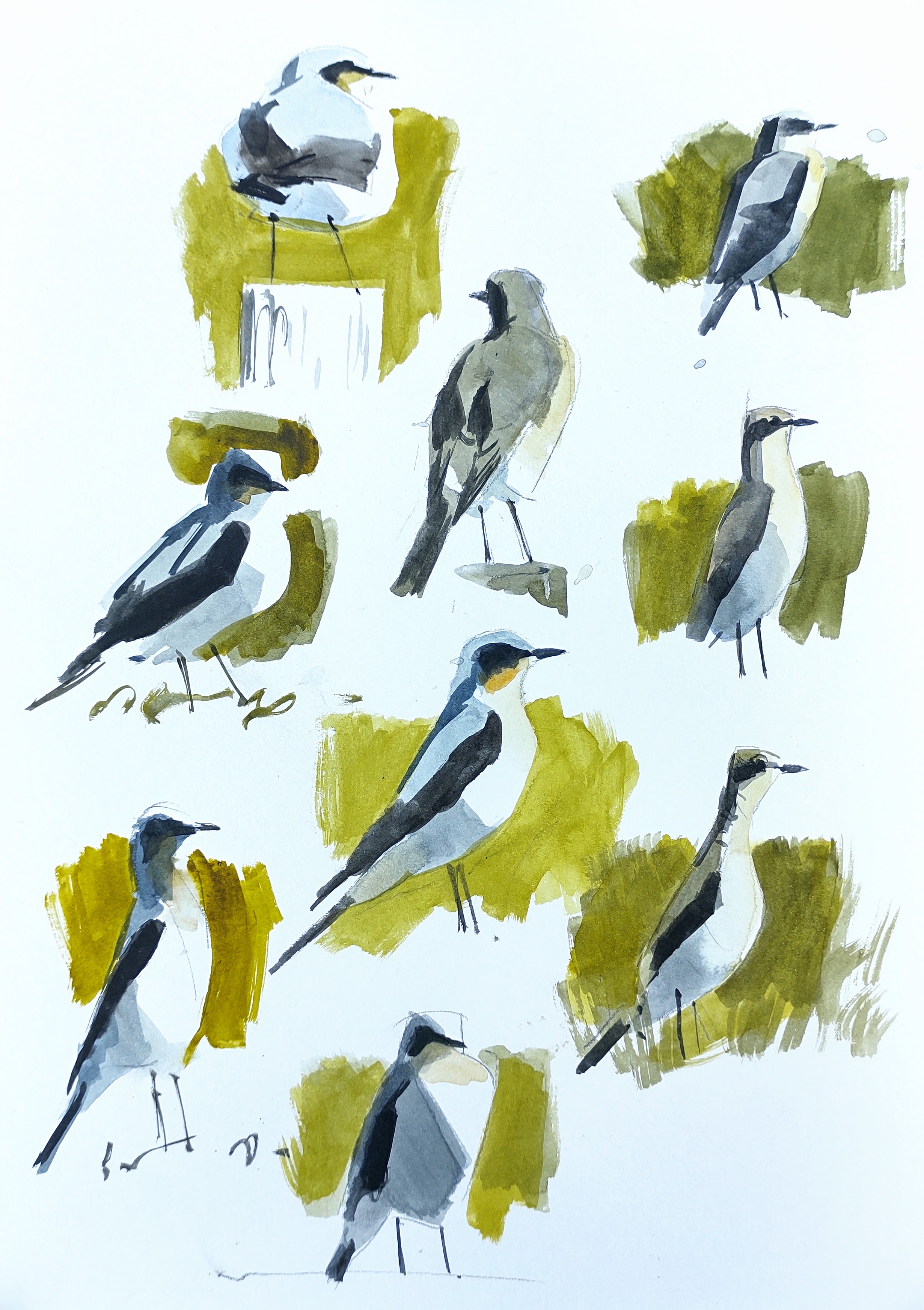
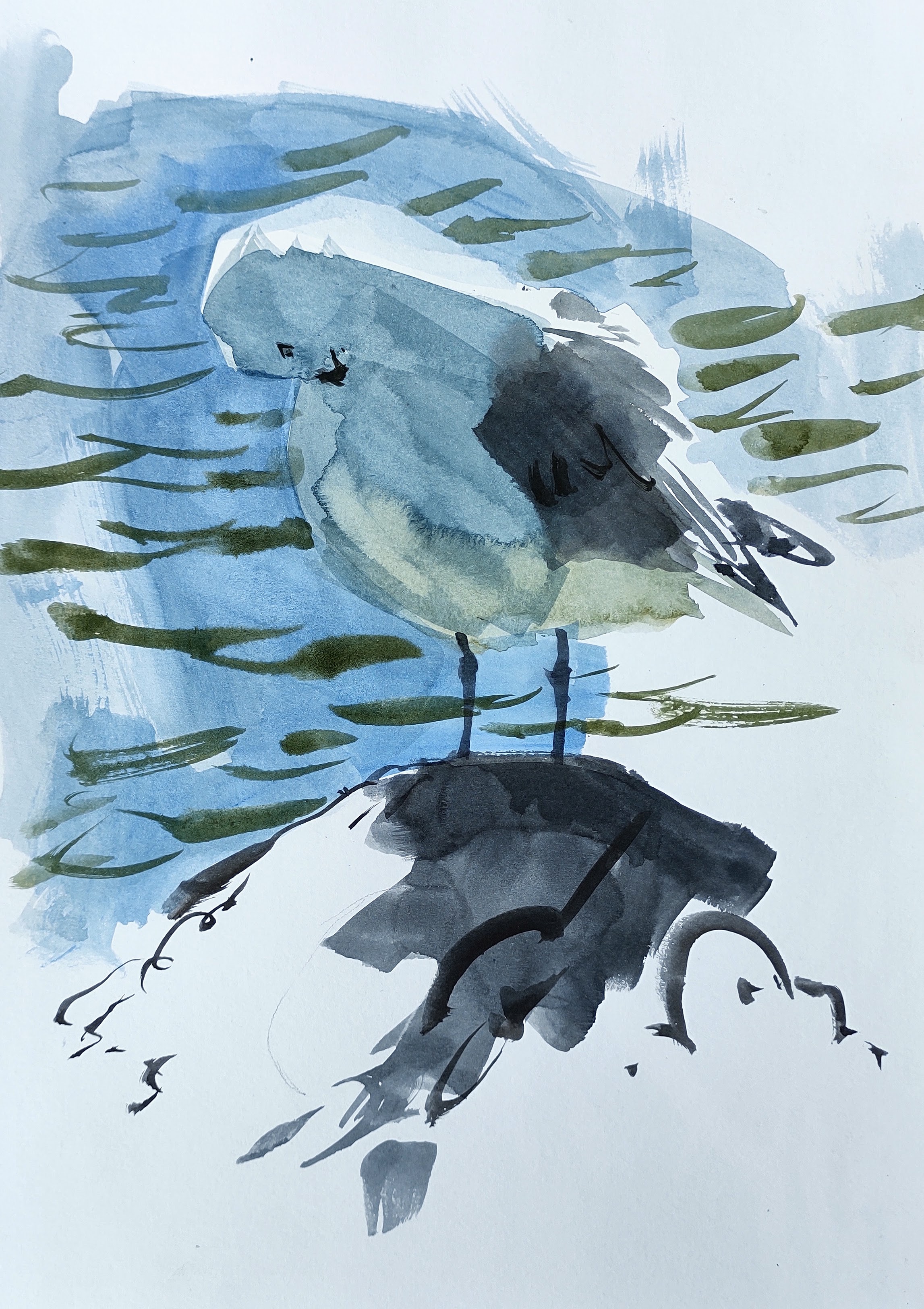
BIRDS SEEN and HEARD – 50 species: 5 new (icterine warbler, red-backed shrike, house martin, swift, cuckoo) running total = 111 species

LESSONS LEARNED – more water needed – I ended up boiling water from the stream.

IN MY HEAD – so much. I knew the area well, so I thought often of previous trips and encounters, my kids and so on. I thought a lot about time and impermanence, how things come and go (paths, ponds, railways, fields, barrow graves…)

LAND 20 – Skelbro til Lundestenen, 19.05.23

Denne side på dansk her

LAND 20 Dawn, 4:45 am. After the drop-off I walked westwards from the Skelbro quarry, and then north into the flat fieldscape of southern Bornholm. It was cold, with a partial ground frost, but clear and still. Embraced by the sound of birdsong and the sickly-sweet scent of the luminously yellow oilseed rape I painted the huge windmills as the sun rose beside me.

Windmills at dawn, seen from Vasagaardsvejen

The area I found myself in has been earmarked by the Danish Government as the site of a huge high voltage transformer station to process energy harnessed from two gigantic offshore windfarms. I tried to imagine the landscape completely transformed. Southern Bornholm is scarred by countless attempts to extract mineral wealth from the landscape in some from or other, but Energiøen is on a completely different scale. At present people living in the area stand to receive no compensation.

I stopped for a coffee with a good friend in Sose, and then walked along the edge of the precipitous and narrow valley of lilleå (‘Little Stream’) that cuts deep through the fields on its way to the sea. In the steep and shaded valley – one of the very few truly ‘wild’ and uncultivated parts of Bornholm – I managed to find a spot to have some lunch. With the light breeze, cherry blossom intermittently floated snow-like down through the tangled mass of knotty boughs, before settling on the narrow stream far below.

Emerging from the valley I walked along the main road. My mood darkened as I struggled to work with the watercolours in the hot sun. Always something to moan about. The day was long, I was underslept and exhausted, my mood swinging pendulum-like with the self-determined success, or lack thereof, of each completed painting.

Looking south from Søndre landevej

I walked along the coastal path again, parallel to the sea, and tried to capture the kaleidoscope of greens as the sun shone through the leaves of the trees.

Green leaves

I took a short detour past wonderful old farms to visit a bronze-age rock carved with petroglyphs. Here I rested for a while. I pondered the importance and significance of these archaeological sites – both for my LAND project, and also in general.

Hellerestningsten. Lille Strandbygård

Down towards the coast again, I walked along a well-known path between Sose and Arnager, I was now entering a part of Bornholm I knew rather well.

The pier at Arnager

As I walked north again out of Arnager, I was entranced by some billowing white plastic sheets covering a potato field.

Watering potatoes, Arnagervejen

All around this part of southern Bornholm, fields were being watered due to the lack of rain. The evening was delicious now, my mood improved immeasurably. I walked along empty county roads accompanied by nightingale song, as the lowering sun cast a golden light over the fields.

Watering fields, Sorteengevejen

The day’s destination, Lundestenen, was another barrow grave – Bornholm’s largest and finest.  I struggled to find a path, and eventually had to walk across cultivated fields to reach the burial mound, where it sat marooned, like a desert island surrounded by a field of green. The sun slipped behind the trees and the day was done.

LAND 20

WEATHER REPORT – Sunny most of the day. Temperature 3 – 16 degrees. Wind 3 – 5 m/s from the east. Hours of precipitation: 0 hours. Hours of sunshine: 14 hours.

STOPS with the BIVVY – 0

KILOMETRES WALKED – 18.55 km

DAY LASTED – 16h and 27 m

PEOPLE TALKED TO – 7

BIRDS SEEN and HEARD – 43 species: 0 new (!) running total = 106 species

LESSONS LEARNED – Remember, it is a very long day. Anything can happen.

IN MY HEAD – energy and growth. Also, I met several old friends and thought a lot about how long I had been on Bornholm, and how much we are invested in the island.

LAND 19 – Grødby to Skelbro, 12.05.23

Denne side på dansk her

LAND 19 For the first time: no hat, gloves, scarf, or thick jacket. The sun rose into a clear steel blue sky, and from my start point surrounded by fields of yellowing rapeseed, I was completely covered by joyous peals of skylark song. As I slowly headed towards the woods of Raghammer, the skylark song was gradually replaced by the repetitive and overpowering rattle, chack and whistle of the newly arrived thrush nightingales.

I was to spend the first half of the day in the Raghammer Military exercise area. Covering over 300 hectares of forest, dune, and heathland, much of the area is protected on account of its diverse fauna and flora. I headed east and followed the outer boundary along a well-mown and signposted path, through a mixture of scrub and open woodland and accompanied all the way by an intoxicating cacophony of bird song and cherry blossom.

Wild cherry and pine, Raghammer

Eventually I arrived at the coast. Bathed in the morning light, the completely deserted beach was nothing less than paradisical. I was glad to meet the sea again and was reminded of my visit during the KYST project, in the autumn of 2018.

Eider duck, Raghammer Odde

I walked around Raghammer Cape, and then doubled back inland into the open heathland where meadow pipits, yellowhammers, and wheatears flitted about.

Raghammer skydeterræn
Wheatear studies

Overhead a honey buzzard and later a black kite. Huge areas of Bornholm once looked like this, but little heathland remains. A large flock of noisy chattering sand martins were busy excavating their nests in some huge sand bunkers – I was drawn to the light and flickering shadows, but they were seldom still for long enough and I struggled.

The day was long, but I still had a way to go. I was overheating and running out of water, my pack heavy. I headed west through a twisted and sleepy pine forest, and eventually arrived at the small seaside village of Boderne. Passing quickly through, I then followed the coastal path running atop the sandy ridge, parallel to the coast and the route of my KYST walk five years earlier. I was glad for the opportunity to paint some shelduck and a herring gull bathed in the strong reflective light of the sea, familiar and comfortable subjects for me.

Shelduck study, Vester Boderne
Herring Gull study, Vester Boderne

My route took me through wild scrubby meadows and blossoming cherry woods. At places the ridge had slipped towards the sea, exposing the red and green clays that were now cracked and dry because of all the dry weather. A rusty winch was possibly a remnant of the clay extraction industries that had been established here during the 19th and early 20th centuries.

Winch, Munkerup

Just before the mouth of the small Rise stream, I arrived at a natural amphitheater grazed by sheep, and here I paused to admire frothy blackthorn blossom caught by last rays of the setting sun.

Sunset. Gryden, Risestrand

Time was getting on, and I followed the steam inland back towards the main road and my destination, the old limestone quarry of Skelbro.

LAND 19

WEATHER REPORT – Sunny all day. Temperature 11 – 20 degrees. Wind 4 – 7 m/s from the east. Hours of precipitation: 0 hours. Hours of sunshine: 15 hours.

STOPS with the BIVVY – 0

KILOMETRES WALKED – 14.93 km

DAY LASTED – 16h and 02 m

PEOPLE TALKED TO – 0

BIRDS SEEN and HEARD – 57 species: 14 new (Black-throated diver, Common eider, Goldeneye, Red-Breasted merganser, Kestrel, Common Sandpiper, Sand Martin, Yellow Wagtail, Meadow Pipit, Thrush Nightingale, Wheatear, Garden Warbler, Whitethroat, Wood Warbler) running total = 106 species…incredible to see so many birds in one walk!

LESSONS LEARNED – I need to have a soft water bottle, so I can fill up in small sinks.

IN MY HEAD – despite the amazing weather, I fought against a bad mood and the symptoms of a cold all day

LAND 18 – Kastelsbakke to Grødby, 05.05.23

Denne side på dansk her

LAND 18 Kastelsbakke – ten past five in the morning. I hunkered down in the shelter of some trees and got to work, swaddled in layers and layers of thick clothing to protect me from the bitterly cold east wind.

The view from Siegårdsvejen

I headed back up into the forest, partly to find shelter, but also because my planned route in Raghammer had been postponed due to military exercises. Some of the younger beech trees were already in leaf with wild cherry and plum trees in blossom, but it was difficult to stop and paint because of the gusting wind. A striking male pied flycatcher brightened my mood somewhat.

View from Højlyngsvejen

Despite the sun, my mood was soon darkened again by the constantly gusting wind. The painting board strapped to my rucksack caught the wind like a sail and I tacked and stumbled along the exposed country roads, heading south again towards the southern flatlands.

Looking south from Lille Myregårdsvejen

I passed quickly through the bungalows and well-kept gardens of Aakirkeby village, feeling like a stranger from another time and space. Back into the fieldscape, the first green shoots were emerging in smart green rows.

A field, Kratgårdsvejen

The wind, if anything, was increasing in severity. I arrived at Jættedal, a passage grave built in the late stone age over five thousand years ago, and first excavated in 1883. On my hands and knees I crawled inside and here in the womb-like inner chamber, I was somewhat protected from the wind.

View from inside Jættedal

Eventually, like a reluctant newborn baby, I crawled back out and faced the wind. Later, I found shelter in a small wood and even managed to catch forty winks, lying on top of an electricity box. The newly restored Saxebro Windmill looked fantastic in the late afternoon light.

Saxebro Windmill

I was flagging but still had many hours to go. After a long search I manged to locate Grødby menhir, hidden close to the banks of Grødby stream in some thorny scrub. According to the faded information panel, the site should have been accessible to the public, but there were no signs or paths, and the panel was almost hidden behind brambles and hawthorn.

Grødby Menhir

To finish off, I sat by the bridge and looked towards the setting sun and the meandering stream – completely windblown and exhausted, but glad to have made it through the day.

Grødby å, from the bridge

LAND 18

WEATHER REPORT – Sunny morning, hazy then cloudy in the afternoon. Temperature 5 – 7 degrees. Wind 10 – 14 m/s from the east. Hours of precipitation: 0 hours. Hours of sunshine: 10 hours.

STOPS with the BIVVY – 0

KILOMETRES WALKED – 19.57 km

DAY LASTED – 15h and 29 m

PEOPLE TALKED TO – 0

BIRDS SEEN and HEARD – 42 species: 2 new (pied flycatcher, lesser whitethroat, running total = 90 species)

LESSONS LEARNED – I hate wind even more that I hate rain (maybe?).

IN MY HEAD – I had just spent four days with a group of artists, working on September’s Klippekroppe project. Ideas, conversations and images were rattling around in my brain.